|
|
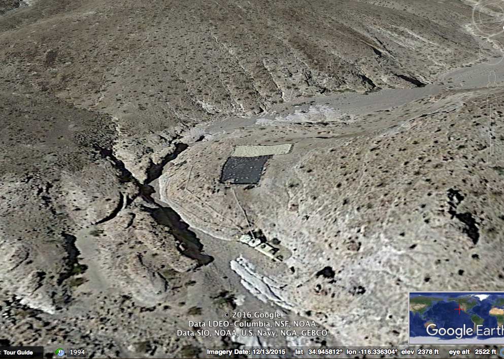
| Afton Canyon: |
Afton Canyon is often called
“the Grand
Canyon of the Mojave.” It was originally called Cave Canyon, but
acquired the current name after the railroad
stop of Afton was created at the west end of the canyon. It’s one
of the few places where the Mojave River flows above
ground in places all year round. Four-wheel drive vehicle
access is
permitted through most of the canyon, however no vehicles are allowed
in the far western end, where the “horseshoe” bend is and where the
caves are located. This closed area is
accessible on foot only. It may be bypassed in your vehicle from the
east by taking the access road along the railroad tracks and then by driving
through the Mojave River wash and under the railroad trestle.
Afton Cemetery is located south of where Afton Station once sat. There
are five stone-covered mounds and wooden crosses. One of the burials has been
identified as that of Jose Flores, born about 1882, died May 29, 1906.
Flores was one of three men who arrived at Afton Station on an
early-morning train hoping to be hired on by a local mine. They were
intoxicated and attacked Section Foreman
Robert Y. Williams, who
was severely injured in the brawl. Flores was killed. The other
two
were wounded, one other reportedly died later. [Reference: John V. Richardson, Jr.,
San Bernardino County Museum Association Quarterly, Vol. 55, Number 4,
2010].
MojaveRd1West Pages 5, 6. GPS:
35.030936,-116.366846
|
| Arbuckle
Mine: |
Arbuckle Mine was a magnesite (magnesium) mine
high up on
the side of a cliff on the south side in Afton Canyon. A large piece of
timber at the mine has "Arbuckle Mine 1894" carved into it. At one time
there was an aerial tramway to carry the ore down the cliff and across
the Mojave River wash to a railroad siding. Arbuckle was later called
the
Cliffside Mine.
MojaveRd1West
Page 6.
GPS: 35.021987,-116.350769
|
| Bitter Springs: |
Bitter Springs is a large spring among a green
foliage area
(mostly mesquite and cattails) along the Salt Lake Trail (also known as
the Mormon Trail or Spanish Trail). It sits in the Mojave Desert
30 miles northeast of the Forks of the Road, a place where the Salt
Lake Trail
splits from the Mojave Road a few miles west of
Camp Cady. The name, Bitter Springs, was given for its brackish taste,
although the water was drinkable.
Bitter Springs is currently off limits to
the public because it's within the borders of present day Fort Irwin.
The Army takes steps to preserve and protect the area from
damage during training.
Found in
Scale Map. GPS: 35.2271814,-116.4316653
|
| Bonanza King Mine: |
Bonanza King Mine is located on the eastern slope of
the
Providence Mountains. Silver was discovered in this area in 1880 and
soon a large mining operation was built. A ten-stamp mill was brought
in from San Francisco and the mine employed as many as 150 men earning
a wage of $4 per day. The nearby town of Providence was built with a
post
office, two general stores, two hotels, a saloon, a blacksmith and a
survey office. By it’s closure in
1885, 1.7 million dollars in silver had been mined (valued at over $40
million today). Ruins of the town
still remain along with stone walls of at least a dozen
buildings.
MojaveRd18ProvidenceEast
Page 5. GPS: 34.980278,-115.505278
|
| Brannigan Mine: |
Brannigan Mine is located in the Old Dad
Mountains. It's the most
intact mine in the area. Gold was discovered at the Brannigan Mine in
1905. It was sparsely mined until 1930 when M. A. Sisley and John
Herrod found high-grade ore and relocated the claims. From
1938 to 1940 it yielded 51 tons of ore with 59 ounces of gold and 20
ounces of silver (source: Geology and Mineral Resources of the Ivanpah
Quadrangle). Despite the short mining period,
the Herrod family lived at the claim into the 1970s, with John
Herrod’s grandchildren returning in April of 2012 to visit the
site.
There are still two cabins there that are maintained by a local 4WD
group and are open and available for use to all 4WD explorers.
They ask only that you please leave them in the same or better
condition as you found them. The Oro Fino Mine
is a short distance further up the same road.
MojaveRd1West
Page 14. GPS: 35.192629,-115.892476
|
| Camp Cady: |
Camp Cady is located on the northern bank of
the Mojave
River a few miles east of Barstow. Camp Cady was established in 1860 by
Major James H. Carleton of the U.S. Army. Their purpose in the area was
to punish local Paiute Indians who had been attacking wagon train
travelers and had murdered a cattleman and some other travelers near
Bitter Springs. Bitter Springs was located on the Los Angeles to Salt
Lake Trail
and it is currently within the Fort Irwin Training Center north of
Barstow. Carlton's superior in San
Francisco, General Newman S. Clarke, ordered him to "proceed to Bitter
Springs
and chastise the Indians you find in the vicinity." The General
specifically instructed Carleton that "the punishment must fall on
those
dwelling nearest to the place of the murder or frequenting the water
courses in its vicinity."
After establishing his base at Camp Cady, Carlton
sent out patrols looking for hostiles. On April 22nd, 1860, on
Carlton's orders, the bodies of
two Native American men, who had been slain earlier by a detachment of
troops on the Mojave River at the Fish Ponds, were taken to Bitter
Springs.
There at the site of the earlier attack, the bodies were hung from an
improvised scaffold. Then after another engagement at
Old Dad Mountain on May 2nd, the heads
of three more natives killed were cut off, taken to Bitter Springs and
placed on display with those already hung. On May 28th,
following reports of the displays in the San Francisco press, General
Clarke ordered Carleton to stop mutilating
the dead and remove all evidence of the mutilation from public gaze.
Camp Cady was eventually abandoned after 1871 when it was
deemed the Paiutes had been sufficiently pacified.
MojaveRd1West
Page 1. GPS:
34.940513,-116.599452,
34.945869,-116.589727
|
| Carruthers Canyon: |
Also spelled Caruthers Canyon, this is a
2 mile deep and a fairly wide canyon in the New York Mountains. This
location has some higher elevations from about 5300 to 6000 feet and it features
plenty of trees, rock formations and hiking trails. It’s
a popular spot for camping and can become more crowded. A few of the features: Giant Ledge
Mine (at the end of the Carruthers Canyon Trail), Phallic Rock and
Stone Table Campsite, a primitive camping area (AKA: Phallic Rock
Camp).
MojaveRd5PintoNY
Page 8. GPS: 35.230132,-115.300869
|
| Death Valley Mine: |
Death Valley Mine is located 4
miles north of
the junction of Mojave
Road (Cedar Canyon Rd) and Cima Rd. Or about 2.5 miles southeast of
Cima. The mine is near the junction of where Cima Rd turns from north to
northwest. It's a great site to visit and
to spend an hour or two walking around and exploring.
It was founded in 1906 by
local Kelso resident J. L. Bright. Later that year Bright sold the mine to the Death
Valley Gold Milling and Mining Company of Denver. A camp
by the name of Dawson sprang up nearby, named after the Dawson
brothers, who became directors of the mining company. Dawson Camp served
as a
community for the workers of not only the Death
Valley Mine, but other mines that played a part in the Cima Mining
District. In 1907, Death Valley Gold Milling and Mining Company and
neighboring Arcalvada Mining and Milling
Company consolidated and became known as the
Death Valley-Arcalvada Consolidated Mines Company. Between the two
mines, seventy-five men were employed
as of November 1907. The total haul for 1907 was estimated at
around 75,000 ounces of silver. The mine was active until the 1930s
and later revived for a short time in the 1950s. It has been a ghost town
ever since. Overall silver production was estimated at $131,000.
A
number of structures still survive,
including a large two-story home, a small single story home, as well as
a number of shops and sheds. There are also several mines with old
equipment still in place. There are NO “private property” or "no
trespassing" signs. There may be a gate that will keep vehicles out if
it's locked, but it's often OPEN. If it's locked, then access is still
ok by foot. Mining
equipment litters the landscape, most of it appearing to be from the
1950s
reactivation.
To reach Death Valley Mine from Mojave Road (Cedar Canyon Road), turn
NORTH on Cima Rd., drive 4 miles. The mine will be easily found on your right.
To reach it from Cima, turn EAST onto Cima Rd. from the intersection of
Kelso-Cima Rd and Morning Star Mine Rd. and drive across the RR tracks. Continue
EAST for 2.5 miles and you'll see the mine on your right.
MojaveRd4CIMA
Page 2.
GPS:
35.21861,-115.464722
|
El Dorado
Cañon Road:
|
The Mojave Road intersects with
El Dorado Cañon Road in Lanfair
Valley at mile 96.1 (43.7 if traveling east). This intersection may be seen at MojaveRd2East
Page 27. GPS: 35.139792,-115.217798.
El Dorado Cañon Road travels northeast from that intersection
and then
merges with the East Lanfair Valley
Trail about 11 miles away in the northeast corner of Lanfair Valley.
This stretch of El Dorado Cañon
Road running through Lanfair Valley is nearly a straight line. It's
faint
in some areas, but still visible and appears mostly navigable for its entire
length, although there may be parts that traverse private property. So you may need to go around at some places.
At north-east corner on Lanfair Valley. Intersection with East Lanfair Valley Trail at MojaveRd7EastLanfairTrNo
Page 8.
GPS: 35.228664,-115.060938.
This northeastern wagon route was important to travelers in the 1860s
as an early route to the north. After 28 miles it would pass through
the site (which
eventually became a mining camp), now known as Searchlight, Nevada,
founded in 1897. It
then turned north to El Dorado Cañon near the
Colorado River
(about 28 miles north of Searchlight). Beyond El Dorado Cañon
was
Las Vegas where there were connections to the Salt Lake Trail.
El Dorado Cañon is located in southern Clark County, Nevada (about 20 miles north of Searchlight) near
the small town of Nelson. The canyon got famous for its rich silver and gold
mines. There are mine tours in the area near the Techatticup Mine, one
of the oldest and historically most productive mines in the area.
|
Forks of the Road:
|
Forks in the Road was the location where the
Salt Lake Trail split off from the Mojave Road. It’s location was a short
distance west of
Camp Cady. The trail began on the north side of the Mojave River wash
and traveled northeast to the Alvord Mountains and then to Bitter
Spring, a popular water stop for immigrants on the trail, which is now
within
the Fort Irwin military base and off limits to the public. See Scale Map. The exact location for Forks in the Road is
not currently known, but it is believed to be near Minneola Road and Cajalco Blvd
in rural East Barstow here:
34.908806,-116.768698.
|
Fort Mojave:
|
Fort Mojave was originally named
Camp Colorado when it was established on April 19, 1859 by U.S. Army
Lieutenant Colonel William Hoffman during the Mojave War. It was
located on the eastern bank of the Colorado River at Beale's Crossing,
near the head of the Mojave Valley in Mojave County, Arizona. The site
was recommended by Lieutenant Edward F. Beale, who had previously
explored the region.
The fort was used as a base of
military operations against the Mojave Indians. With 50 soldiers,
Lieutenant Hoffman reportedly defeated 200 Mojave in a battle in the
summer of 1859, after which hostilities with the Mojave ended. Two
years later, after the start of the American Civil War, Brigadier
General Edwin V. Sumner ordered the post abandoned and the
buildings burned on May 28, 1861, in order to withdraw the regular
troops to garrison Los Angeles against an anticipated secessionist
uprising. Later that year the regulars were sent east to serve with the
Union Army.
On May 19, 1863, the post was rebuilt and infantry troops reassigned to
protect travelers along the Mojave and Prescott road. This time the
Infantry successfully cultivated friendly relations with the Mojave
Indians. These volunteer soldiers also took up prospecting and
established mining claims in the area and many later found they did not
want to leave. Many of them would return after being mustered out after
the
end of the Civil War. After the end of the Indian Wars, the fort was
transferred in 1890 to the Bureau of Indian Affairs. In 1935 it was
transferred to the Fort Mojave Indian Reservation. The location is
currently administered by the state of Arizona.
MojaveRd2East
Page 37. GPS:
35.044115,-114.622305
|
Fort Piute:
|
Fort Piute was established in
late 1859 by U.S. Army Captain James H. Carleton. It was eventually
made a sub-post of Camp Cady. It's found near Piute Springs in the
foothills of the Piute Mountains, 23 miles west of Fort Mojave at the Colorado River.
Captain
Carleton originally named the post Fort Beale for Lieutenant Edward F.
Beale, U.S. Navy. In 1857 to 1859, Lieutenant Beale and his caravan of
camels famously explored the area for a suitable wagon road to the
west. The
name was later changed to Fort Piute. Fort Piute was abandoned in 1868.
MojaveRd2East
Page 31. GPS: 35.115020,
-114.985260
|
Fred Welch Home:
|
Homestead of Fred L. Welch,
circa 1914. Mojave Road at intersection with Caruthers Canyon Road.
MojaveRd2East
Page 26. GPS: 35.13999,-115.25584
|
Government Holes:
|
Government Holes was originally named Banning’s Well. It was dug in 1859 by employees of Phineas Banning (who was
considered the "Father of the Port of Los Angeles, the founder of
Wilmington, California, and the man for whom the City of Banning,
California was named). Banning's Well was later renamed Government
Holes after U.S. solders enlarged and improved it in 1860. Even though
the plural
"Holes" is used, there is only one well. Countless early travelers have made
use of this well, but it has mostly been used for cattle
operations in the area. The most famous incident at Government Holes
occurred on
November 8, 1925, when two men, Matt Burts and J. W. "Bill" Robinson,
shot it out in a cabin there. Both were killed.
MojaveRd2East Page 24. GPS:
35.149245,-115.354778
|
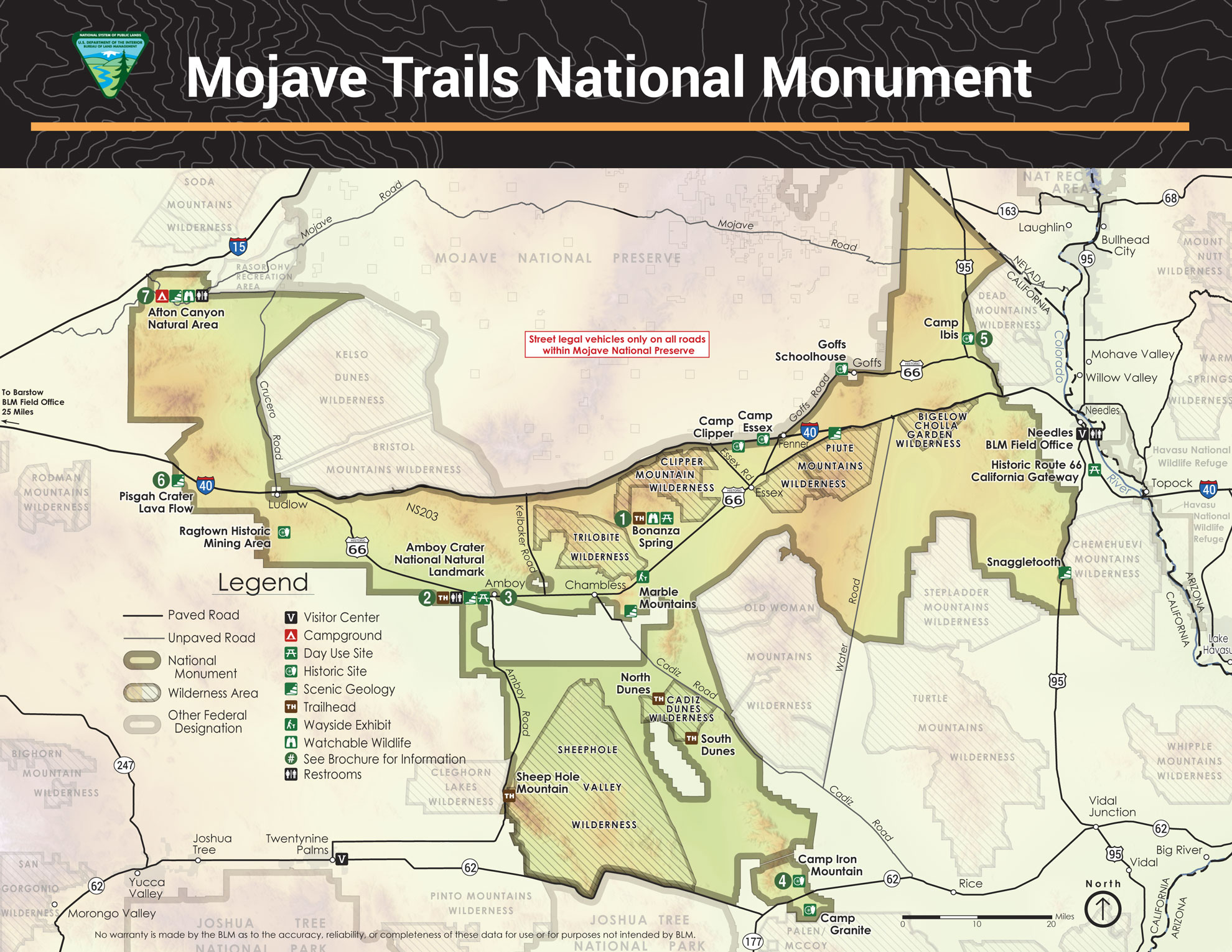
Hole in the Wall Campground:
|
Hole in the Wall Campground is located at
about 4,300 feet elevation and surrounded by sculptured volcanic rock walls.
It has 35 campsites with areas large enough for motorhomes or trailers
and two walk-in tent sites. Facilities include pit toilets, picnic
tables, fire rings, trash cans, and drinkable water on a limited basis.
There are no utility hookups but there is a sanitary disposal
station. Campsites available on a
first-come, first-served basis. Fee info and more at the NPS campground link: https://www.nps.gov/moja/planyourvisit/campgrounds.htm.
MojaveRd6BlackCanyonRd
Page 4. GPS:
35.045382,-115.392908
Camping for larger groups (up to 15 to 50 people): The Black Canyon Equestrian & Group Campground
is located across Black Canyon Road from the Hole-in-the-Wall
Information Center. Fee and reservation contact info can be found in the
NPS campground link above.
|
Indian Petroglyphs
and Ancient Water Well:
|
This is a very large collection of large
rocks on a hill which display hundreds of detailed and clear petroglyph
drawings. Also you’ll
discover a large natural stone well on the southwest side of the hill.
The site is well-preserved, with
minimal vandalism. There are a few inscriptions from early white
travelers with dates ranging from 1900 to 1919. The well still
holds water, however appearing a bit stagnant. It’s easy to miss this
place,
but worth the visit. It's only about a mile out of your way when on the
Mojave Road.
MojaveRd2East Page 28. GPS: 35.145670,-115.159135
|
Indian Spring:
|
You may find the road leading
east to Indian Spring off of Kelbaker Road at
GPS:
35.215086,-115.876568.
This intersection is about 0.7 mile north of the entrance of the lava
flow split (south of Seventeen Mile Point). This is NOT the same
road as Indian Springs Trail, which is a few miles south. Indian
Spring can be found about 3.5 miles east of Kelbaker Road.
Near MojaveRd1West
Page 14.
The approximate location of Indian Spring is GPS:
35.232219,-115.821186
|
Jackass Canyon:
|
Before the Mojave Road as we
know it now was created, the earliest wagon route to the west in this area originally cut due south from Marl
Springs, instead of northwest, as it does now. It then crossed a large valley (now occupied by Kelbaker Road) and then went over
Rocky Ridge, through Jackass Canyon, and almost due west across the wide, flat, sandy expanse, which is now known
as Devil's Playground. This route
was abandoned around 1859 due to harsh, rocky terrain on Rocky Ridge and deep
sand in the canyon.
MojaveRd3MarlSouth Page 4. GPS:
35.079913,-115.842572
|
Kelso
Depot:
|
Kelso Depot was built in 1924
and was used as a railroad depot until 1962. It's a Spanish Mission
style building, with red-tile roof and graceful arches. At its peak
during World War II, the town of Kelso supported 2,000 residents. The
depot's diner, the Beanery, served customers 24 hours a day for many
years. Once slated for demolition, the depot was saved and has been
restored by the National Park Service for use as a visitor center. The
Beanery was still open until just a few years ago, but it's no longer there.
GPS:
35.012148,-115.653252
|
Lanfair Valley:
|
Most of the eastern Mojave was
opened to homesteading by the US government in 1910. That year,
inspired by the gospel of dry-farming techniques, and sensitive to the
potential increase in value of property with good access to
transportation, Ernest Lanfair, a merchant from Searchlight, claimed a
portion of the valley that would later bear his name. His homestead and
several others became the heart of a community along the railroad.
Migration to the area rose sharply in 1912 as word
spread free land and Lanfair's bumper crops. Settlers, referred
derisively by cattlemen as "nesters," established a post office, a
general store and a school. Further north, a settlement at Ledge had
similar amenities. A 1914 Fourth of July community barbecue, hosted by
Lanfair, counted some 400 participants. Future residents would rent
boxcars from the Santa Fe Railway, known as "immigrant cars," load all
of their possessions, and then meet the boxcar later on a
siding in Lanfair Valley. Newly arrived migrants staked and recorded
their claims and then worked to clear land, build homes and plant a
portion of the land to
meet government requirements. Many claims went back to the government
after the homesteaders failed to make sufficient improvements. Later
homesteaders would come along and take over semi-improved claims of
former residents who left before
receiving a full title to the land. When that happened, the process of
gaining
title from the government would begin again, but many of theses new
arrivals could find places with improvements and they might not have
construct a place to live from nothing.
Ernest Lanfair’s home can still be seen along the Mojave Road at an intersection of an unknown road at MojaveRd2East Page
28. GPS
35.131571,-115.16512
|
Lava Tubes:
|
The Mojave Desert Lava Tubes are
off of Aiken Cinder Mine Road 3 miles north of the Mojave Road. After
reaching the the lava field you can park along the road. There's a short trail leading east to a hole in the ground with a heavy steel ladder.
The ladder takes hikers down into the tubes, which can be explored.
There are a few small skylights above which light things up a little,
but bring a flashlight if you
want to explore inside away from the main hole.
MojaveRd2East
Page 16. GPS: 35.216348,-115.751417
|
Marl
Springs:
|
Also known as Camp Marl Springs, this site was
first garrisoned as a small informal Army outpost by troops from Camp
Cady and Camp Rock Spring in October 1867. It was continuously occupied
until May 1868, when it was abandoned permanently. In 1867 the post was
reportedly surrounded by hostile Indians. During a 24 hour siege the
station had a
full test of its position. There were only three men there but they
came out with their scalps intact. In the true spirit of the West, just
at dawn a rescue column of soldiers cut through the besieging circle of
Indians to save the post. Marl Springs continued to be an important
station on the travel route across the Mojave Desert. It also served as
the site for
several trading posts. Some old deserted structures and ruins still
occupy the site. Crumbling rock walls mark the site of the old Army
post.
MojaveRd2East Page 19. GPS:
35.170700,-115.647590
|
Mid Hills
Campground:
|
This 26-spot campground off of Wild Horse Canyon Road is
nestled in pinyon pine and juniper trees at 5,600 feet elevation. Temperatures
are typically 10 to 15 degrees lower than at Hole in the Wall Campground
(elevation: 4,300 ft.) further to the south.
Facilities at Mid Hills include pit toilets, picnic tables, fire rings,
trash cans,
and drinkable water on a limited basis.The short road to the campground
is
not paved, but very accessible to normal vehicles. It is not recommended
for motorhomes or trailers. Campsites available on a first-come,
first-served
basis. Fee info and more can be found at the NPS campground link:
https://www.nps.gov/moja/planyourvisit/campgrounds.htm.
MojaveRd6BlackCanyonRd
Page 6. GPS:
35.131637,-115.435568
|
Mojave Cross:
|
The Mojave Desert Veterans
Memorial and cross was erected in 1934 by the Veterans of Foreign Wars
(VFW) in
honor of World War I veterans and those who were killed in action.
Riley Bembry, one of the founders of the memorial and a veteran of
World War I, took care of the cross until his death in 1984. Shortly
before his passing, he asked his friend, Henry Sandoz, to care for the
memorial. Henry and his wife, Wanda, have looked after
the cross since then. In 2001 the ACLU filed a lawsuit on behalf
of Frank Buono, a former Mojave Preserve employee, then living in
Oregon, who claimed he was offended by the cross. He argued the cross
was unconstitutional, because it
was located on government land. Lower federal courts agreed, ordering
the removal of the cross. In 2003 Congress passed a law to
transfer the property to the VFW, however the court prohibited the
transfer. Liberty Institute stepped in and filed an amicus
brief at the U.S. Supreme Court on behalf of the VFW, The American
Legion, Military Order of the Purple Heart and American Ex-Prisoners of
War. In 2010 the U.S. Supreme Court heard the case and reversed
the lower court
ruling. They declared that the law passed by Congress in 2003, allowing
the property transfer to the VFW, was constitutional. The transfer was
made in
exchange for other land in the Mojave Desert owned by Henry
Sandoz. Days after that ruling, vandals stole the cross. It was
later recovered 500 miles away and returned. Article:
https://adfmedia.org/press-release/us-supreme-court-says-mojave-cross-veterans-memorial-can-stay
On Cima Road 10.8 mile north of
the Mojave Road. GPS:
35.314280,-115.548789
See Scale Map.
|
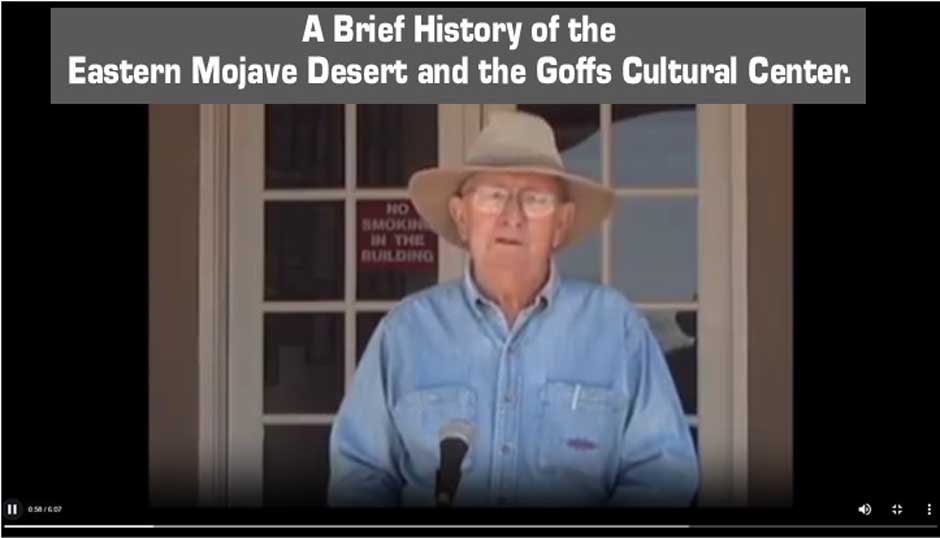
Mojave Desert
Heritage and Cultural Association:
|
The Mojave Desert Heritage and
Cultural Association is located at 37198 Lanfair Road in Goffs, CA.
Visit www.mdhca.org.
This
location features a cultural center and museum as well as the restored
Goff’s Schoolhouse, originally built in 1914. The center is open a
limited number of days each week, so be sure to check the web
page. They
can also open the facility for visiting groups with a few days advanced
notice. The center is funded through donations, so your
generosity is appreciated.
|
Mojave Desert
Megaphone:
|
This is one of the peculiar mysteries of
the eastern Mojave Desert. There are a lot of speculative stories on
the internet about what it is and why it was made, from a warning siren
to a gun sight to a drum or maybe just a practical joke. Or maybe just
plain art. Either way, no one seems to know how long ago it was
placed there. MojaveRd15CadyMtns-Crucero pages 12 &
13. GPS:
35.0054,-116.1964.
|
Mojave Phone Booth:
|
This was a lonely phone booth installed in 1948 for to provide phone service to local mine workers (phone number 760-733-9969).
It became an internet novelty in the 1990s and began attracting fans
and visitors. The booth kept getting vandalized, so it was removed by
Pacific Bell in 1997. Fans of the booth erected a headstone
commemorating it, but that was later removed by the National Park
Service. It location was on a north-south utility road about 6.7 miles
north of the Mojave Road Mailbox. GPS:
35.285827, -115.68463
|
Mojave Road
Mailbox:
|
Be sure to stop at the Mojave
Road Mailbox at Mojave Road mile 74. This metal box and flag pole with
U.S. flag was installed in 1983 by the Friends of the Mojave Road, an
affiliate of the Mojave Desert Heritage and Cultural Association in
Goffs, CA. Visit www.mdhca.org.
There is a register book inside the
mailbox for Mojave Road travelers to sign in, record their passing and
leave
comments. It seems the flag pole went missing in recent years, but the box is still there.
MojaveRd2East
Page 18 GPS:
35.185400,-115.692840
|
Nevada Southern
Railway Monument:
|
A large concrete monument on the
southwestern corner of the Mohave Road and Ivanpah-Lanfair Road.
A brass
plaque reads the following:
“Nevada Southern Railway. In January
of 1893 construction of Isaac C.
Blake’s Nevada Southern Railway commenced northward from Geoffs toward
Manvel (later known as Barnwell) for the purpose of hauling ore from
the mining districts of southeastern California and southern Nevada. It
soon went bankrupt and was reorganized in 1895 as the California
Eastern Railway. Six years later the line was extended north into
Ivanpah Valleyand in July of 1902 was acquired by the Santa Fe
Railroad. Four years later the Barnwell & Searchlight Railway was
built from Barnwell to the mines at Searchlight, Nevada. After 1918 the
Santa Fe abandoned part of it’s line in the Ivanpah and only ran trains
beyond Barnwell when warranted by demand. Several substantial washouts
and continuing unprofitability caused the Santa Fe to abandon their
rails north of Goffs in 1923. Lanfair and Ivanpah Road parallel the
former Southern Nevada Railway grade as it proceeds northward from
Goffs, then runs directly upon it for part of the distance through the
New York Mountains. Sections of the roadbed, washed out in several
places, can be seen from Ivanpah and Lanfair Road. This monument has
been erected on a portion of the original grade used by the N S and C E
Railroads.” “Plaque dedicated October 12, 2008, by the Billy
Holcomb Chapter of the Ancient and Honorable Order of E Clampus Vitus
in cooperation with the Mojave Desert Heritage & Cultural
Association.”
MojaveRd2East Page 27. GPS:
35.13866,-115.186983
|
Old Dad Mountains:
|
This mountain range received the
name “Old Dad,” after Joseph “Old Dad” Wallace, a railroad worker from
Kelso who later became a prospector. Wallace was accused of murdering
his fiancée, which prompted him to leave town. He moved to this
mountain range with a team of donkeys to prospect.
MojaveRd1West
Page 14, MojaveRd2East Page 15. GPS:
35.158779,-115.875728
|
Oro Fino
Mine:
|
The Oro Fino Mine is one of the
earliest mines in the area. It began production in the 1890s. The
expense of moving the ore at the time is what likely shut the mine down
after a few years. The mine was reactivated in the 1930s and operated
through 1943, producing about $50,000 in gold. It’s just past the
Brannigan Mine on the same road.
MojaveRd1West
Page 14.
|
Paymaster Mine:
|
The Paymaster Mine, also known
as the Whitney Mine, was the largest producer in the Old Dad Range.
It’s most relevant years were from 1900-1914. Water was piped in from
Indian Spring and it had a mill operating in 1911. It is estimated to
have made between $50,000 and $100,000 before being shut down in 1914
due to litigation. The mine was reopened in 1930 and was active on and
off through the 1980s.
MojaveRd1West
Page 14. GPS:
35.199127,-115.906398
|
Penny Can:
|
The Penny Can is an old can
(often several cans) hanging from a tree on the north side of the
Mojave Road
at about head level. Tradition is to leave a penny as a tongue-in-cheek
contribution to Mojave Road maintenance. According to Dennis Casebier,
when the Mojave Road was being developed for use as a recreational trail in 1983,
a can was found hanging here with a few pennies inside. Extra cans
were reportedly added after the first one became full.
MojaveRd2East
Page
27. GPS:
35.135488,-115.177167
|
Piute Springs:
|
Piute Springs are natural
springs about 3500 feet distance up the canyon toward the west from
Fort
Piute. It's generally isolated and only accessible by foot,
since vehicle traffic is prohibited past the fort by the NPS.
MojaveRd2East
Pages 30, 31. GPS:
35.110825,-114.996066
|
Rock Spring:
|
Camp Rock Spring was established
by the U.S. Army on December 30, 1866 as a small outpost of Camp Cady.
Water was a problem at the post. The spring was poor and irregular and
water had to be brought in from a mile west at Government Holes. It was
maintained as an army post until May 21, 1868.
MojaveRd2East
Page 25. GPS:
35.152830,
-115.327300
|
Rocky Ridge:
|
Before the Mojave Road as we
know it was created, the earliest wagon route to the west proceeded
due south from Marl Springs instead of northwest as we know it now. From there it would eventually cross
a large valley (now occupied by Kelbaker Road), then over
Rocky Ridge and through Jackass Canyon. After exiting
Jackass Canyon, the route would cross the expanse of Devil’s
Playground. This route across Devil’s Playground is nearly due west
from Jackass Canyon on a 25 mile track directly to the east end of
Afton Canyon.
This route was reportedly abandoned around 1859 due to harsh terrain on Rocky
Ridge
and deep sand in the canyon and beyond. The road down Rocky Ridge
is really no longer
visible, but you can still see the lines of stones that were moved aside
down the ridge, allowing you to see where the wagons used to go. If you want to see it, Rocky Ridge is
now easily
accessed on foot from a nearby power line road.
Details here: MojaveRd3MarlSouth Page 3. GPS:
35.110814,-115.794721
|
Stray Cow Wells:
|
During the Civil War the US
military spent time scouting the Mojave Desert looking for suitable
routes for moving men and supplies to the west. Captain George Price was
given such a commission and in 1864 he led a company of men from Salt
Lake City to Fort Mojave. They then traveled west to a water well called Lewis Holes.
During Captain Price’s journey, his company came upon a stray cow at a
watering hole nearby. Price's men killed and ate the cow. The
watering hole was then given the name Stray Cow Wells in commemoration of the event.
This well is located south of Searchlight, Nevada on the El Dorado Cañon Road
Trail at the California/Nevada line. MojaveRd7EastLanfairTrNo Page 5. GPS: 35.331488,-115.043951.
|
The
Triangles:
|
The Triangles are located on a mesa overlooking
the Mojave River Wash, on the north west side. They were created by
unknown people by removing rocks from the desert surface. They are
easily visible and may be accessed by a side road where you can climb up the
back of the mesa. There is a line of posts to prevent you from driving
too close, but you can park and walk right up to them. The Triangles are large
enough to be visible in Google Maps images.
MojaveRd1West
Page 3. GPS: 34.986632,-116.486365
|
Travelers Monument:
|
The Travelers Monument is a fun
part of the journey on the Mojave Road. It sits near the center of Soda
Lake. Bring a large rock if you want to add to the monument. Thousands
have done so over the years. Once you arrive, you’ll get to read the
secret
plaque and receive the profound knowledge that only travelers of the
Mojave Road can know.
Do not divulge
this secret inscription to any unworthy non-Mojave Road Traveler.
MojaveRd1West
Page 10. GPS: 35.13086,-116.095365
|


